
The USRL infrastructure consists of a fully-equipped electromechanical laboratory dedicated to the development of UAVs and flights preparation, a mobile ground control station (GCS) for real-time control and monitoring of the unmanned flights and a private paved runway with a hangar and dedicated overhead aerospace.
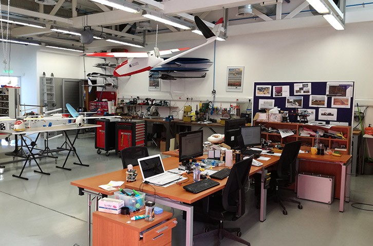
The USRL laboratory
The USRL laboratory is a spacious modern facility located at the CyI premises (Nicosia, Cyprus). It comprises an advanced mechanical and electronic workshop dedicated to unmanned systems research and development. A composite materials workshop is currently being arranged adjacent to the electromechanical laboratory, aiming to serve the innovative unmanned aircraft developments.
The Mobile Ground Control Station(GCS)
The Mobile Ground Control Station (GCS) has been developed in order to enhance USRL ability for missions in remote areas in Cyprus and abroad. The mobile GCS is equipped with cutting edge technology to establishreliable communication link with UAVs for long range missions and reliable data streaming. In addition, it serves as a mobile laboratory for on the field work as well as for the transportation of the UAS.


The USRL Airfield

The USRL airfield resides on the plateau between the villages of Orounda and Peristerona, at a distance of 40 Km from the capital Nicosia. The main runway is 200 m long and 12m wide, whereas the secondary runway is 90 m long and 6 m wide. The UAS exclusive overhead airspace, which has been granted by the Department of Civil Aviation of Cyprus under a permanent NOTAM status, has a diameter of 1 Km and ceiling up to 2.5 Km. Adjacent to the USRL permanent airspace, a 16 Km² area with 2.5 Km ceiling can also be available upon custom request.The USRL airfield is strategically located close to the Cyprus Atmospheric Observatory (CAO) of the Cyprus Institute, which enables the direct comparison of the ground based and airborne atmospheric measurements.
The USRL airfield resides:
NOTAM:
A1843/18 NOTAMR A1215/18
Q) LCCC/QWULW/IV/BO /W /000/090/3506N03305E001
A) LCCC B) 1811220752 C) 1902221534
D) SR-SS
E) UNMANNED AERIAL SYSTEM WILL BE FLYING IN AREA 1 KM RADIUS
OF PSN 350543N0330455E/OROUNTA VILLAGE
F) SFC G) 9000FT AMSL


The capacity of USRL to provide competitive transnational access to its infrastructure, in support to multi-disciplinary Environmental Research, is tested and improved in the framework of the EU-H2020 ENVRI+ project. This new concept aims to offer the scientific community with ready-to-use UAS solutions at the closest of its (research) needs (intensive field campaigns). It complements the customized UAV-sensor systems that USRL develops for atmospheric research (in collaboration with CEA and MPIC) and other UAS applications. Obviously, the USRL infrastructure can be available for other UAS research developments and applications upon custom requests.

